
From mapping systems to 3d digital twins we connect the world.
Location Technology
Overview
Most designers work with static information. Maps taught me to design for things that move - people navigating unfamiliar spaces, sensors updating in real time, fleets making split-second routing decisions.
For several years at Verizon's Location Technology division, I worked at the intersection of spatial data, IoT infrastructure, and human-centered interface design - from stadium wayfinding to LiDAR-based digital twins. That foundation is why I think about complex systems differently than most product designers.
As a designer embedded in Verizon's New Business Incubation division, I worked across the full arc of the Location Technology team's product development - from early-stage consumer experience design on the NFL partnership through enterprise-grade spatial infrastructure for autonomous systems. These weren't design exercises. They were live deployments at Super Bowl scale and beyond.
Where it started:
stadium wayfinding for Super Bowl LIV
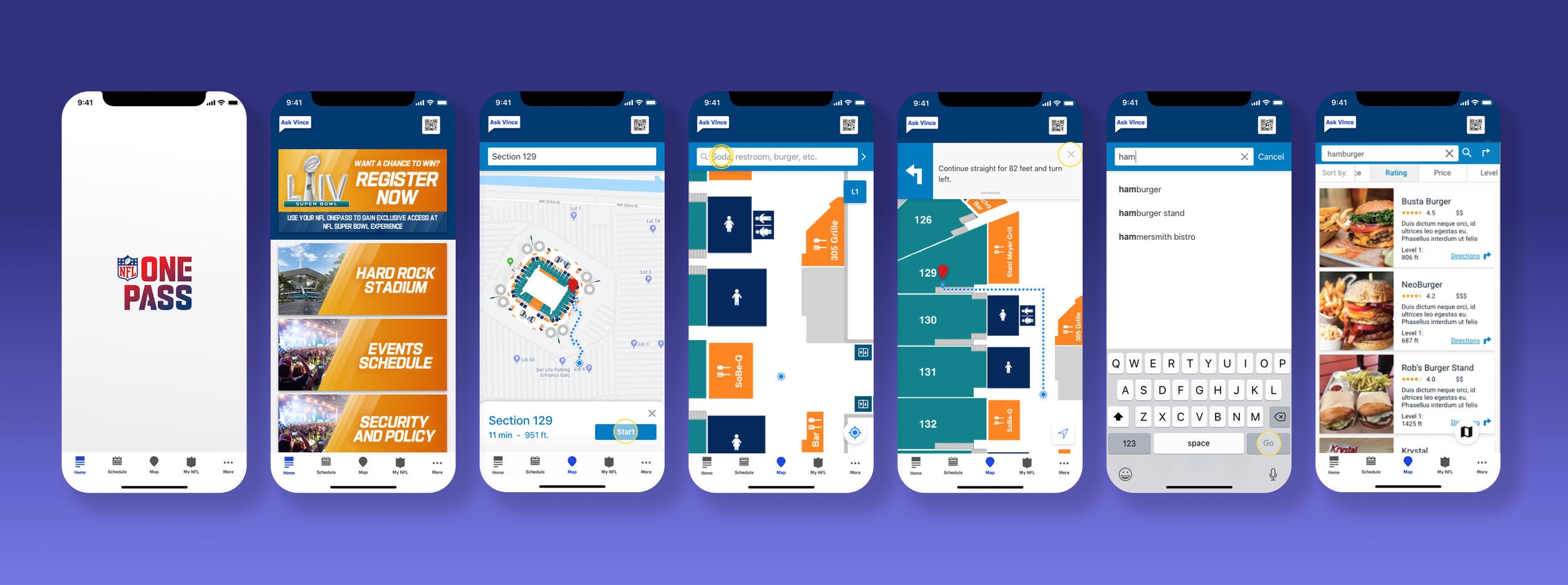
Verizon partnered with the NFL to build indoor navigation into the NFL OnePass app for Super Bowl LIV at Hard Rock Stadium in Miami. Using a network of IoT sensors throughout the venue, the experience gave fans real-time, step-by-step directions to bathrooms, concessions, ATMs, and their parking spots - a personal GPS for 65,000 people in a building where cell signal alone can't tell you which way to turn.
I assisted in designing the in-app navigation UI and the wayfinding interaction patterns - how a fan orients on the map, follows a route, and recovers when they take a wrong turn. The core constraint: it had to work under maximum cognitive load, in a loud, crowded environment, for someone who may have never used the app before.
Taking it enterprise:
indoor positioning at scale
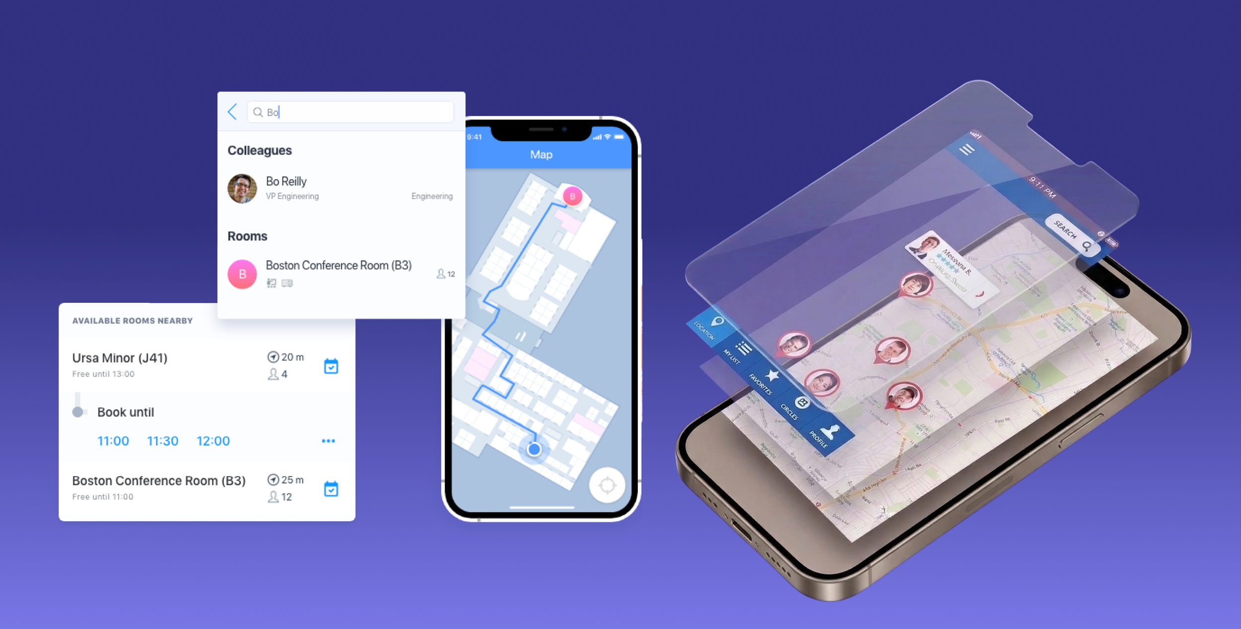
Following Verizon's acquisition of Senion, a Swedish indoor positioning company, the technology expanded from stadiums to enterprise office environments globally. Senion's system combines Bluetooth beacons with sensor fusion to provide GPS-equivalent accuracy indoors - with real-time location tracking, turn-by-turn navigation, and zone-based notifications for administrators.
My work here focused on the design system for the administrator-facing interface - the dashboards and configuration tools that let facility managers set up, monitor, and act on location data across complex physical spaces. The design challenge was translating highly technical spatial data into something a non-engineer could act on quickly.
Beyond the building:
Outdoor precision for autonomous systems
Indoor wayfinding is a solved problem at city scale. Outdoor navigation for autonomous vehicles, drone delivery, and industrial fleets is not. Standard GPS has accuracy tolerances that are fine for a driver making a turn but dangerous for a drone making a delivery or a robot navigating a warehouse.
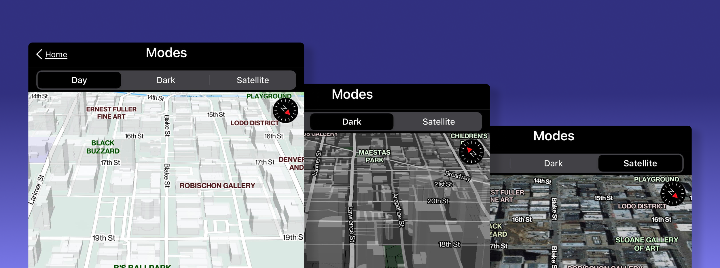
Working with HERE Technologies and Mapbox, Verizon's hyper-precise location system used 5G infrastructure to correct satellite data errors in near real-time - bringing GPS accuracy down to centimeter-level precision. I contributed to the map visualization layer and the interface design for how fleet operators monitored and interacted with location data at scale.
The frontier:
3D digital twins and LiDAR point clouds
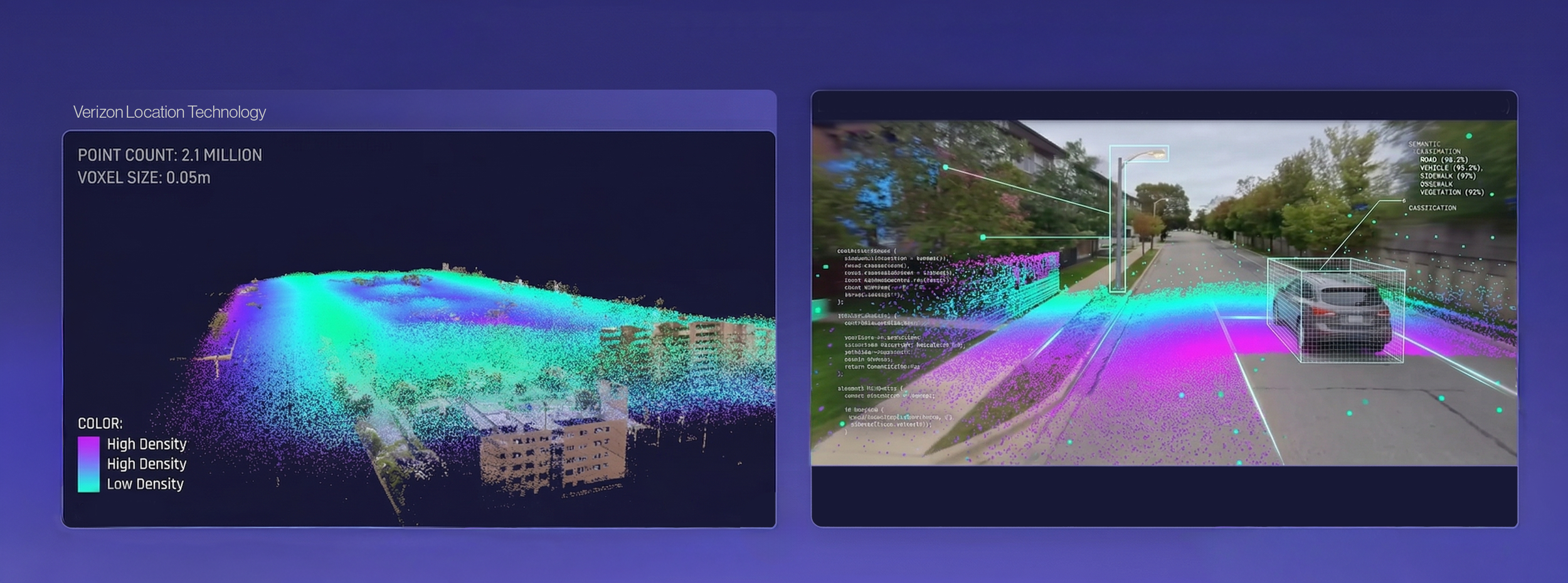
The most technically complex work in the VLT portfolio was Digital Space Orchestration - using LiDAR scanning, AI, and 5G sensor fusion to build real-time 3D digital twins of physical environments. A digital twin isn't just a map. It's a live model that updates as the physical space changes, enabling autonomous robots, vehicles, and people to share the same environment with full situational awareness.
I worked on the visualization and interface layer for these environments - how operators see, navigate, and act on a 3D representation of a space in real time. The design challenge was making something that looked like science fiction feel immediately legible to the people who needed to use it every day.
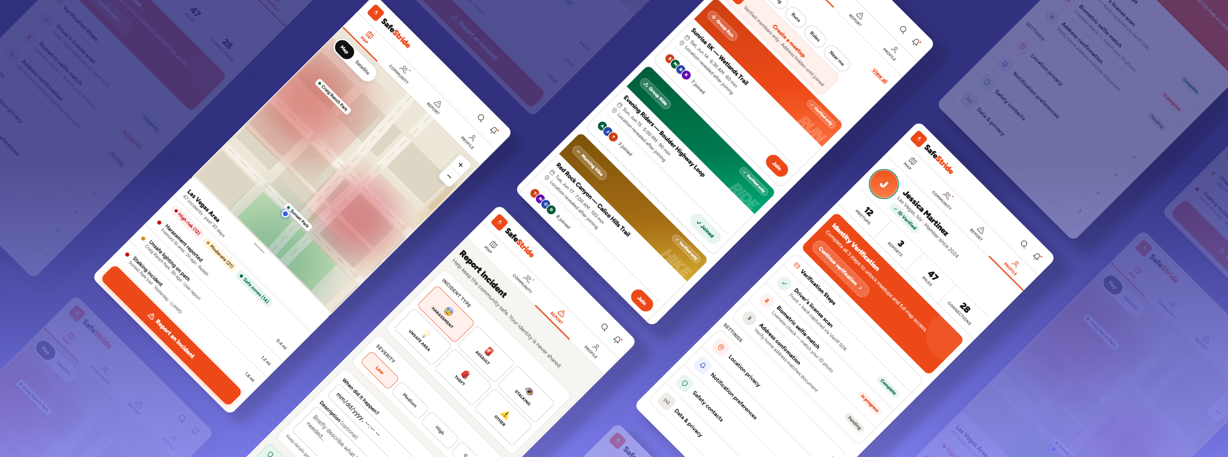
Mapping safety:
Orchestrating Spatial Integrity and Privacy
SafeStride applies this same spatial thinking to personal safety - a Mapbox/PostGIS platform that helps women navigate urban environments using real-time community incident data and privacy-preserving location technology.