
From mapping systems to 3d digital twins we connect the world.
Location Technology
Overview
The Verizon Location Technology (VLT) team, part of the New Business Incubation division, focuses on bridging physical and digital worlds by providing highly-accurate, real-time location intelligence for enterprise customers - enabling precise tracking and management of people, machines, and IoT devices, both indoors and outdoors.
It all started with iot sensor technologies
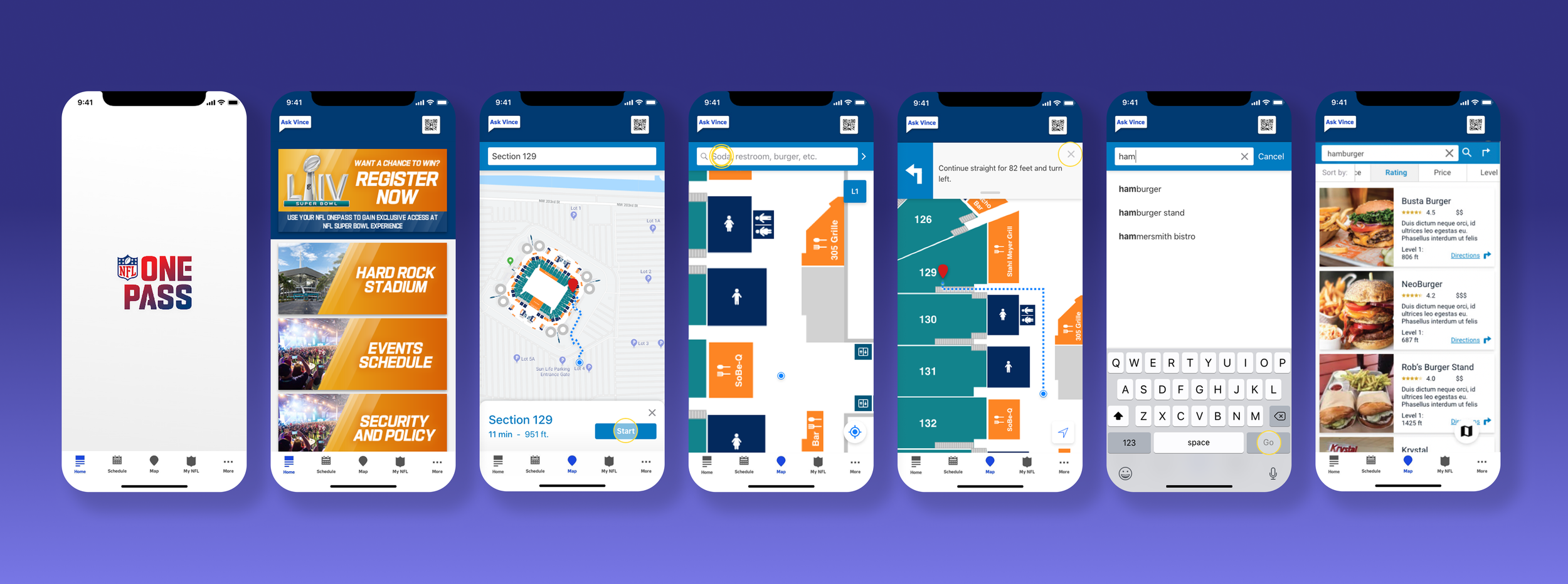
The VLT journey began with A wayfinding solution, simplifying stadium navigation for nfl venues.
For Super Bowl LIV, Verizon teamed up with the NFL to build a smart navigation tool for the NFL OnePass app. It used IoT sensors throughout the stadium, serving as a personal GPS system, giving fans easy, step-by-step directions to find things like bathrooms, snacks, ATMs, and their parking spots at Hard Rock Stadium in Miami, Florida.
pusHing indoor wayfinDIng one step further
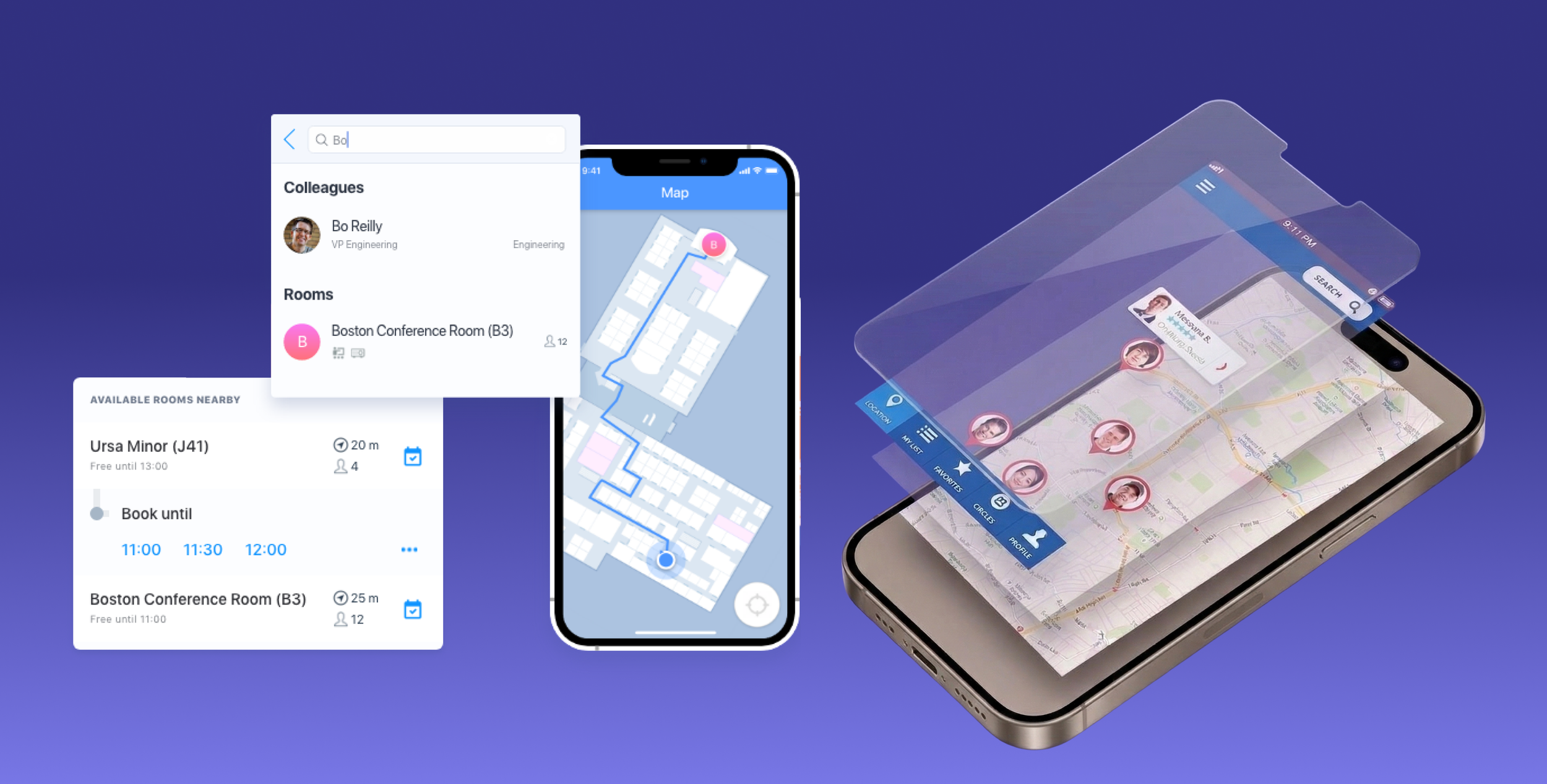
Upon the acquisition of senion, a swedish indoor positioning team, we were able to bring this tech to office spaces globally.
Senion’s Indoor Positioning System (IPS) provides a robust hardware and software framework that acts as the indoor equivalent of GPS for mobile devices. By combining Bluetooth beacons with a sensor fusion algorithm, the technology enables precise, real-time location tracking and turn-by-turn navigation within complex physical spaces. This system is critical for organizations because it improves the visitor experience through effortless wayfinding while providing administrators with valuable location analytics and the ability to send targeted, zone-based notifications.
Takin’ it to the streets
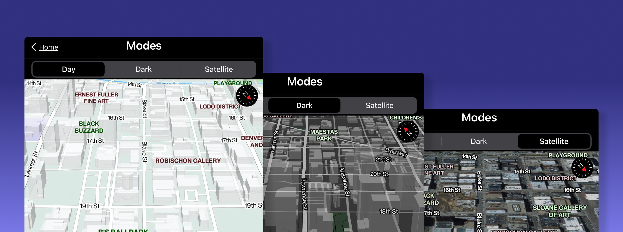
Next, we partnered with partners “here technologies” and “Mapbox” to create outdoor navigation systems for shipping fleet efficiency.
Our hyper-precise map systems and technologies significantly outperformed standard GPS by leveraging Verizon’s 5G technologies to orchestrate a nationwide network and correct satellite data errors in near real-time. This proved to be invaluable for the future of autonomous vehicles, drone delivery, and industrial automation, where pinpoint precision is necessary for safety and efficient navigation.
Digital twins & point cloudS
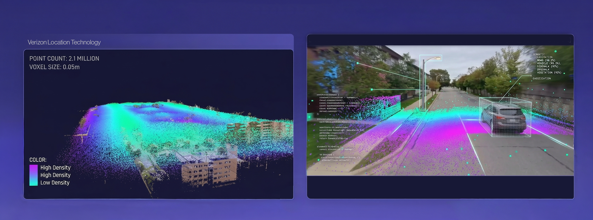
By leveraging lidar point cloud technologies, we were able to construct 3d digital twin ecosystems, helping teams locate key resources.
Verizon’s Digital Space Orchestration uses 5G, AI, and sensor fusion to create real-time digital twins that map and manage complex indoor and outdoor environments. This technology improves safety and efficiency by breaking down data silos to provide the situational awareness needed to coordinate autonomous robots, vehicles, and people.
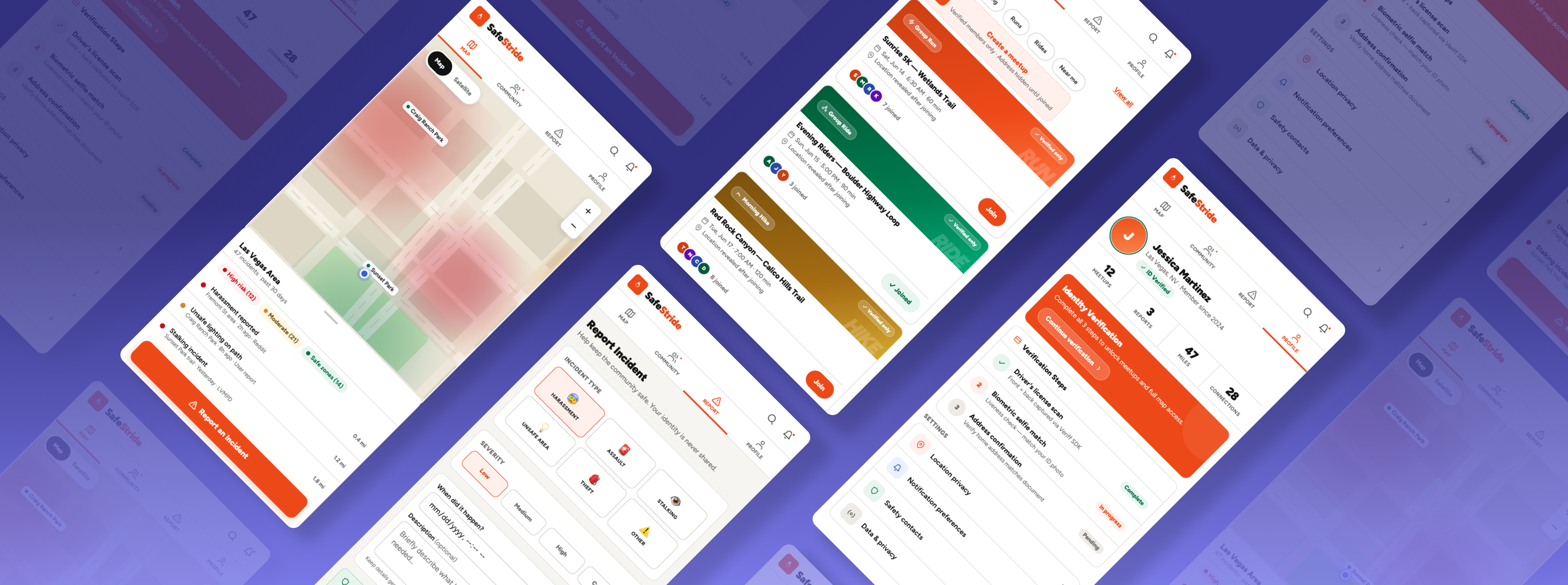
Precision Mapping for Urban Safety
Orchestrating Spatial Integrity and Privacy through PostGIS and Mapbox
SafeStride is a specialized geospatial platform designed to bridge the "anxiety gap" in urban navigation by balancing real-time community reporting with absolute user anonymity. I engineered a minimalist Mapbox interface integrated with a PostGIS backend to handle high-speed spatial queries, implementing a custom Location Jittering API that obfuscates precise coordinates to protect user privacy without sacrificing geographic utility. By merging tenured design leadership with an API-first architectural mindset, I transformed complex spatial joins and biometric verification into a seamless, safety-critical mapping environment tailored for dense metropolitan centers.