Safe Stride
Mapping Safety & Community
Role: Founder / Lead Product Designer & Engineer
Tools: React Native, Mapbox, Supabase, PostGIS, Veriff
Overview:
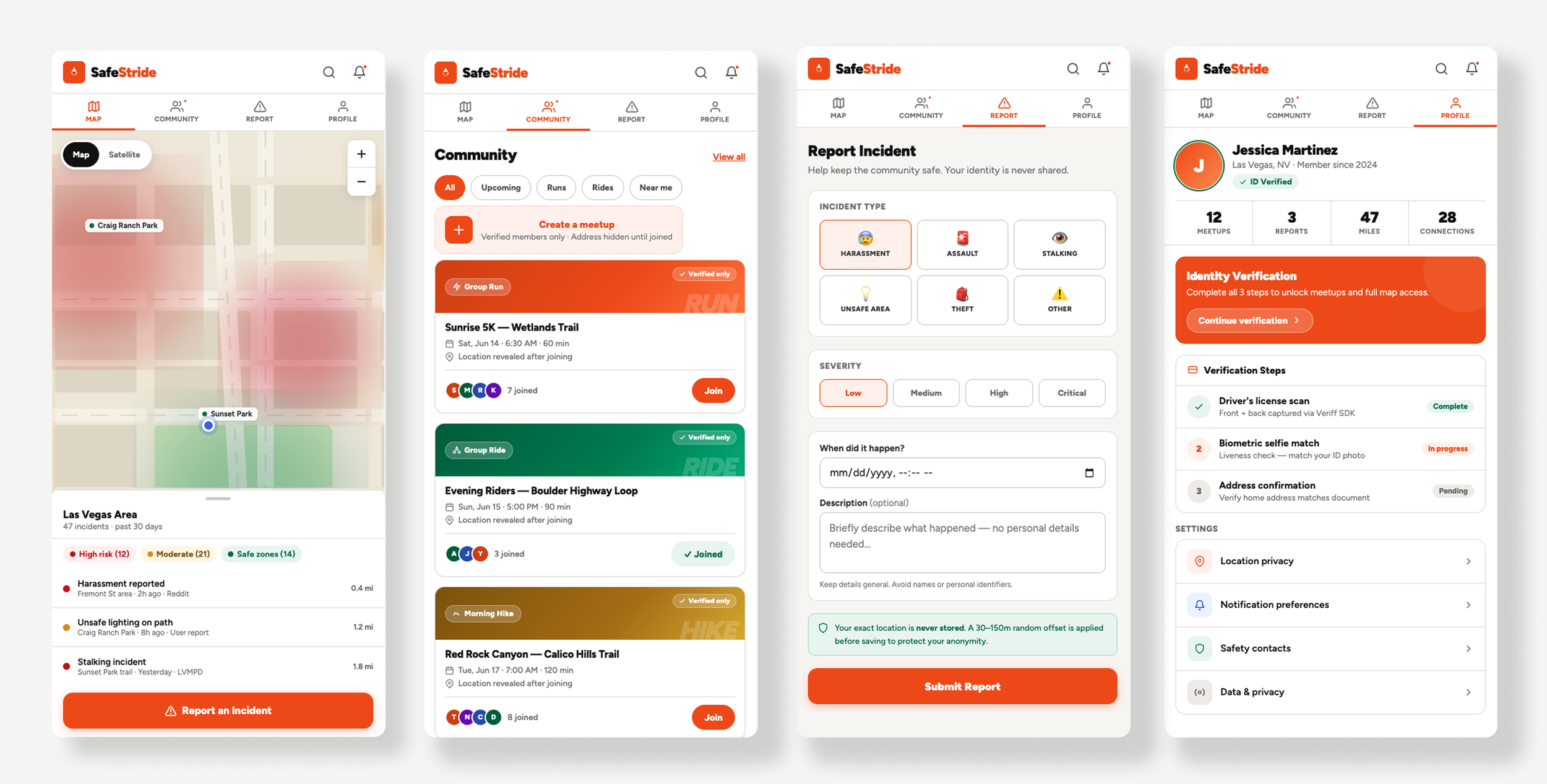
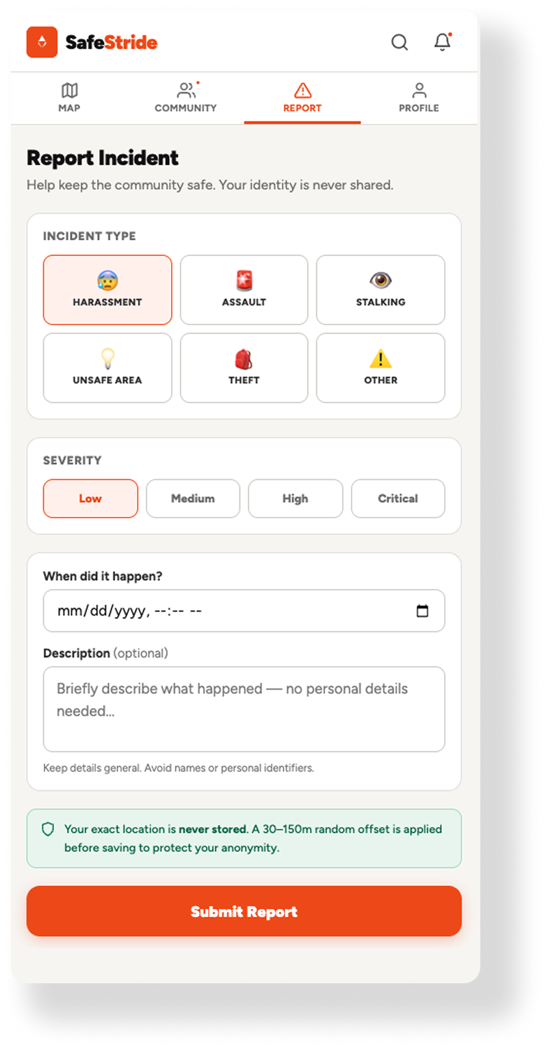
In major urban centers like Las Vegas and Denver, personal safety is a primary barrier to physical activity. While municipal crime data exists, it is rarely actionable or human-centric. SafeStride is a specialized mapping and community platform designed to bridge the “anxiety gap." It synthesizes real-time incident data with a verified, female-only social layer to help women reclaim public spaces for running, cycling, and community meetups.
Problem:
Bridging the Urban Anxiety Gap
For many women in major urban centers like Las Vegas and Denver, navigating the city isn't just about the most efficient route - it’s about the safest one. Existing navigation tools are optimized for traffic and speed, but they fail to account for the “anxiety gap": the lack of real-time, peer-verified safety data and the inherent risks of sharing location information on public platforms.
The challenge was to build a navigation ecosystem that solved three critical friction points:
The Data Void: Static maps don't reflect the shifting safety of an urban environment.
The Trust Deficit: Public social apps are often compromised by bad actors, making “community" safety features unreliable.
The Privacy Paradox: To report a safety concern, a user often has to reveal their own location, creating a new security vulnerability in the process.
SafeStride was designed to turn the city from a source of anxiety into a manageable, transparent environment through verified community intelligence and privacy-preserving technology.
Strategy:
Turning Noise into Intelligence
The primary hurdle was twofold: Data Legibility and Identity Trust.
The Data Problem: Official police reports and community forums provide a flood of “noise" that is difficult to parse while on the move.
The Trust Problem: Existing social apps for athletes lack the rigorous vetting required to ensure a space is truly safe from bad actors.
The Privacy Paradox: How do you allow users to report incidents in real-time without revealing their exact location or home address?
Business Result:
Verified Engagement: Achieved a 1:1 ratio of active users to verified identities, creating a zero-bot/zero-bad-actor environment.
Technical Scale: Built a scalable spatial pipeline capable of processing thousands of geo-localized incidents monthly across multiple metro areas including Las Vegas and Denver.
Precision Cartography & Identity Gating
Leveraging a decade of experience in technical design and an API-First mindset, I architected a solution focused on Spatial Integrity.
1. Human-Centric Cartography
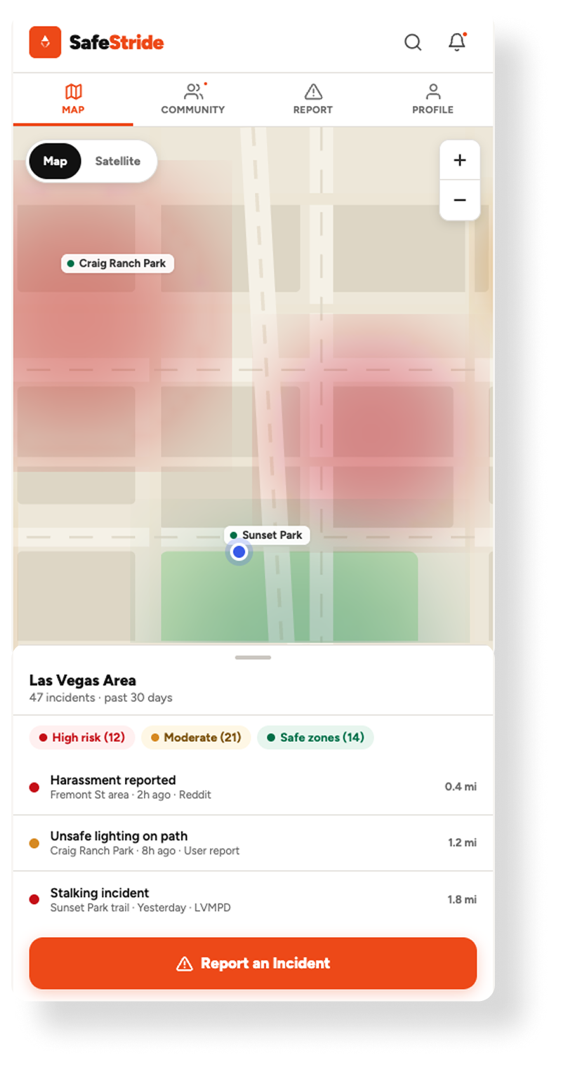
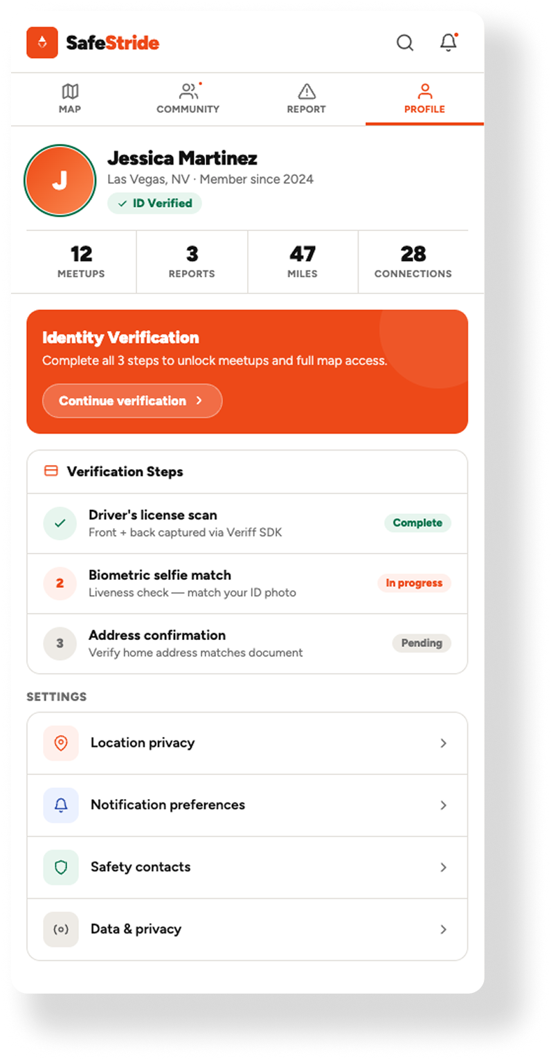
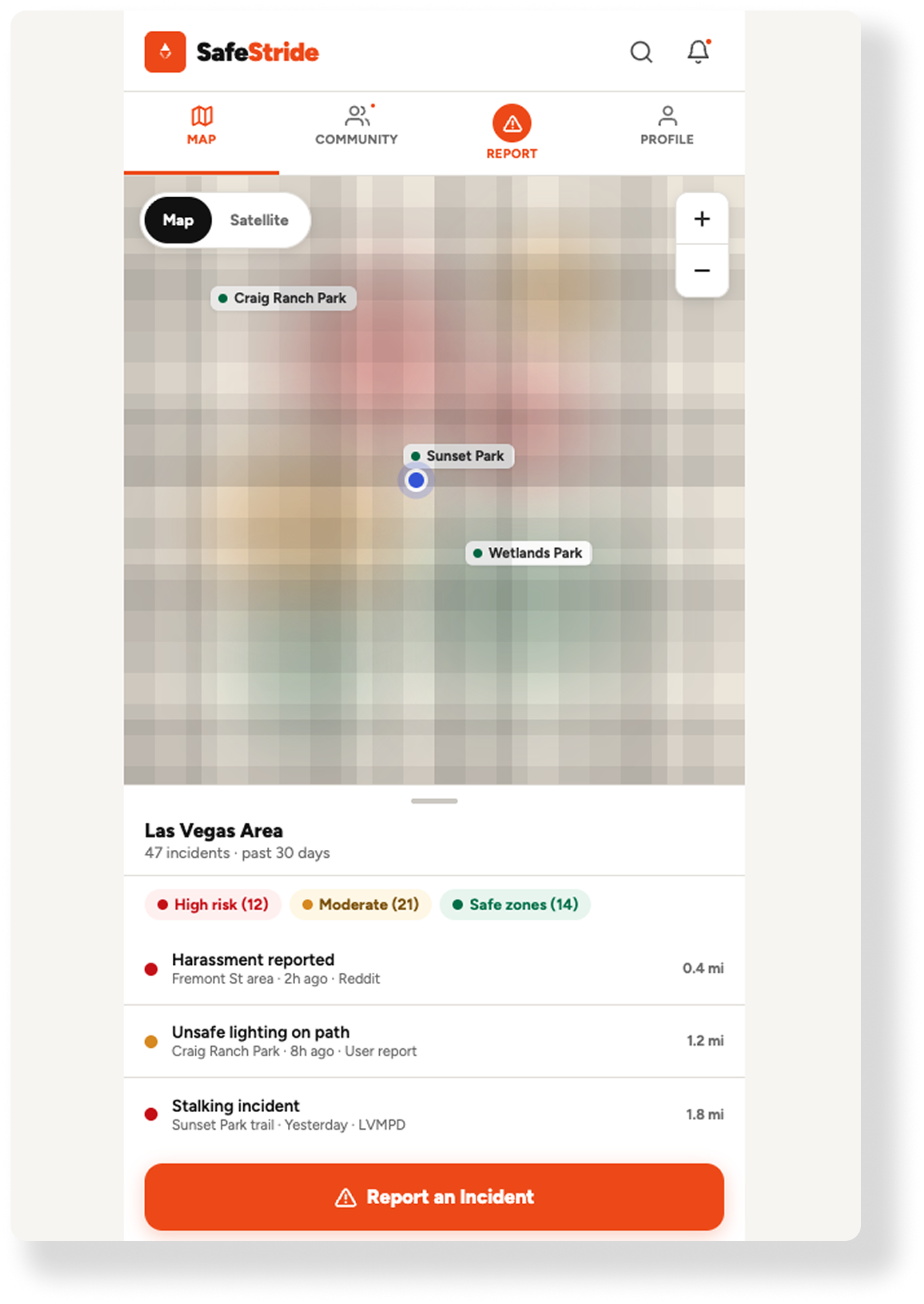
I designed a minimalist Mapbox interface that prioritizes “cognitive ease." Using PostGIS, SafeStride aggregates municipal CAD (Computer Aided Dispatch) feeds and community reports into a dynamic Heatmap Layer. This allows users to identify repeat incidents at a glance without the "clutter" of traditional map markers.
2. The Biometric Gate
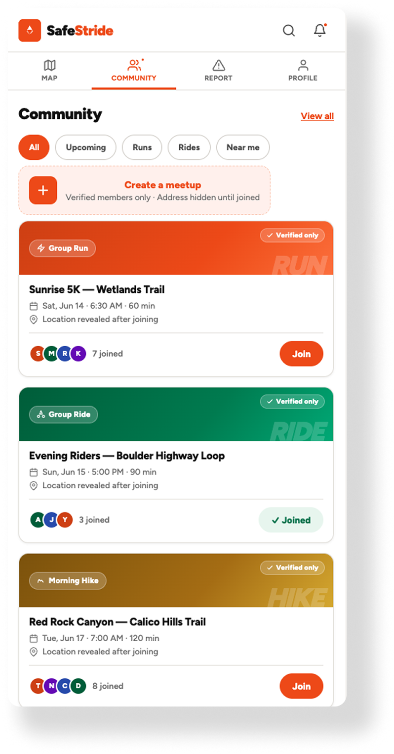
To solve the trust gap, I implemented a fintech-grade onboarding flow. Using biometric identity verification (Doc + Selfie), SafeStride ensures a 1:1 human-to-verified-account ratio. This “high-friction" entry point is a deliberate design choice, transforming the app from a public tool into a private, trusted sanctuary.
3. Privacy through Spatial Obfuscation
I engineered a Location Jittering API. When a user reports a live incident, the system applies a random mathematical offset of 50-100 meters. This maintains the heatmap’s integrity for the community while providing 100% anonymity for the reporter’s specific location.
What I Learned:
Trust is a design choice!
Building this app reinforced that sometimes, friction is a feature. While modern UX often obsesses over “seamlessness," identity verification requires a deliberate pause. I learned how to balance the technical complexity of PostGIS and real-time data ingestion with the emotional need for a calm, minimalist interface. Most importantly, I realized that cartography isn’t just about where things are - it’s about how people feel when they are there.
AI Shortcomings & Straight-Up Failures:
“AI is absolutely incredible with what it can do, but it can be SO dumb in the dumbest ways."
This became my daily motto throughout the development of SafeStride and all other engagements with AI. While the technology accelerated my workflow, it required constant, senior-level course correction in two critical areas:
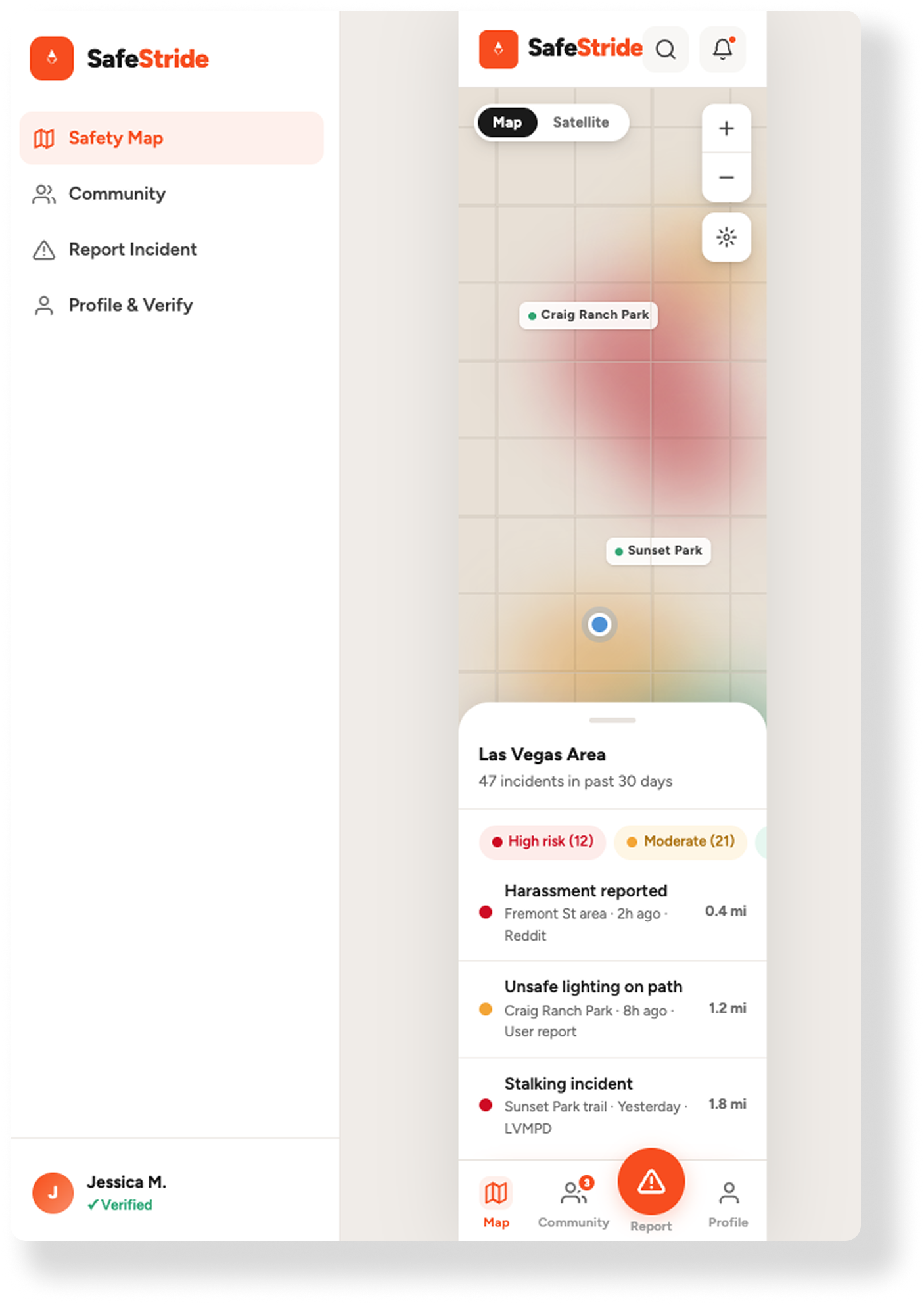
1. The Mobile vs. Web Context Gap
Despite explicit instructions that SafeStride was a mobile-first native application, the first iteration of the UI architecture from Claude was fundamentally flawed. It attempted to force-fit a web-based navigation logic, complete with a complex left-hand sidebar, into a mobile viewport.
The Failure: AI often defaults to the most common training data (web patterns) rather than adhering to specific platform constraints (iOS/Android HIG).
The Correction: I had to pivot from broad conceptual prompts to System-Level Component constraints, manually stripping out the desktop-centric code and realigning the app with a mobile design system.
2. The Mapbox Rendering Struggle (Work in Progress)
The most complex technical hurdle remains the integration of dynamic Mapbox tiles. Despite multiple prompt iterations, the AI consistently struggled with the nuances of Vector Tile rendering and layer initialization within the React Native lifecycle.
The Failure: Every iteration introduced a new glitch - from flickering heatmaps to failed POI label inheritance. This is a classic example of “AI Hallucination" in complex documentation; the model would suggest outdated or mismatched prop syntax for the @rnmapbox/maps library.
The Strategy: Because the stakes of a safety app are too high to rely on “guessed" code, this phase transitioned from AI generation to Manual Documentation Review. Getting the map engine right requires a surgical approach to the Mapbox API that GenAI isn't yet capable of mastering on its own.
See More AI-Orchestrated APPS